

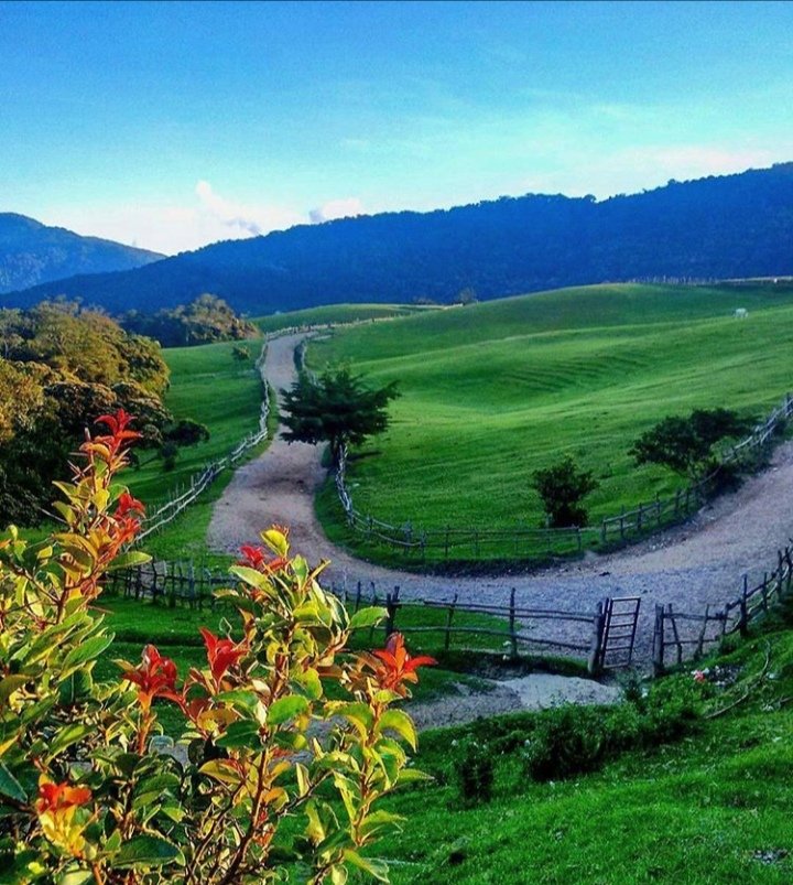
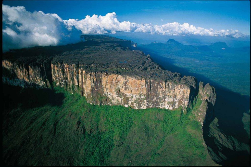
Venezuela has three mountain systems and they have almost nothing in common. The Andes in the west hold everything above four thousand metres, including the glaciers the country has now lost. The Cordillera de la Costa runs along the Caribbean and puts cloud forest forty minutes from a beach. The Guiana Shield, in the south-east, is two billion years old and looks like nowhere else on earth: flat-topped sandstone tepuis with vertical walls, and the highest waterfall in the world coming off one of them.
This page is the overview of the three: where they are, what they hold, which summits are worth the effort and what to prepare before going.
History and culture
The three systems have shaped where people live in Venezuela, what they grow and how the country was fought over. A short account of how.
Geological origins
- Cordillera de la Costa: the product of tectonic and erosive processes along the Caribbean margin. Its origin is tied to the break-up of Gondwana and the opening of the Atlantic.
- Guiana Shield: one of the oldest formations on the planet, going back more than two billion years, and an exceptional record of early geological processes. It is also rich in minerals, which has been both its economy and its problem.
- Venezuelan Andes: part of the longest mountain chain in the world, raised by the collision of the South American and Nazca plates. The process began roughly 140 million years ago and produced the high summits and deep valleys the range has today.
- Effect on biodiversity: the three systems did not just shape the landscape. By isolating altitudes and slopes from each other they created habitats where species evolved separately, which is where most of Venezuela’s endemism comes from.
Indigenous peoples
- In the Andes: the Timoto-Cuica peoples developed terraced farming and irrigation adapted to altitude, and left the agricultural landscape that is still visible around Mérida and Trujillo.
- In the Cordillera de la Costa: Carib and Arawak communities settled the valleys and the coast, living from fishing, hunting and farming.
- In the Guiana Shield: the Pemón, along with the Kariña and Ye’kuana, hold a detailed traditional knowledge of the region, particularly of what is now Canaima National Park and the area around Angel Falls.
- What remains: the languages, the art, the rituals and a body of environmental knowledge that conservation projects in the region now depend on.
Colonial period and independence
- Spanish settlement: the mountains were both an obstacle and a resource. The Spanish established towns in the Andean valleys and worked mineral deposits, particularly in the Guiana Shield.
- Indigenous resistance: mountain terrain favoured the people who knew it, and resistance to colonisation lasted longest in the high country.
- The independence campaigns: the mountains were used tactically. Bolívar’s crossings of the Andes are the best-known example, and several decisive battles were fought in the valleys of the coastal range.
- The Guiana Shield: its remoteness made it a refuge and a supply base for the independence movement.
Economy today
- Farming: in the Andes, coffee, potatoes and other cool-climate crops, plus cattle. The altitude and climate are what make them possible, and they remain the backbone of the local economy.
- Mining: the Guiana Shield holds bauxite, iron, gold and diamonds. It has been a major source of income and the source of most of the region’s environmental damage.
- Tourism: trekking, ecotourism and adventure travel, concentrated in Mérida and in Canaima. Where it is organised locally it works; where it is not, the money leaves the region.
- Conservation and development: the current argument in all three systems is how to keep the economic use without losing the thing being used.
The three mountain systems
The Venezuelan Andes
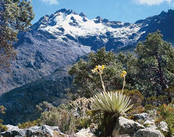
The Venezuelan Andes cross the states of Táchira, Mérida and Trujillo. The landscape is páramo and cloud forest, and the range holds the highest point in the country, Pico Bolívar.
- Getting there: mainly by road, from Mérida or San Cristóbal.
- Flora and fauna: Andean condor and spectacled bear, puma and deer, with frailejones and orchids on the ground.
Main summits of the Venezuelan Andes
- Pico Bolívar (4,978 m) — Mérida. The highest mountain in Venezuela. Alpine climate, bare rock and ice patches at the top.
- Pico Humboldt (4,940 m) — Mérida. The second highest, and the mountain that held the country’s last ice until 2024.
- Pico La Concha (4,922 m) — Mérida. Alpine, very low temperatures at the summit.
- Pico Bonpland (4,883 m) — Mérida. Next to Humboldt, similar conditions.
- Pico Espejo (4,765 m) — Mérida. The top station of the cable car; the only summit at this height reachable without walking.
- Pico El Toro (4,755 m) — Mérida. Cold mountain climate.
- Pico El León (4,740 m) — Mérida. Cold mountain climate.
- Pico Pan de Azúcar (4,680 m) — Mérida, in the Sierra La Culata.
The full guide is in the Venezuelan Andes.
Cordillera de la Costa
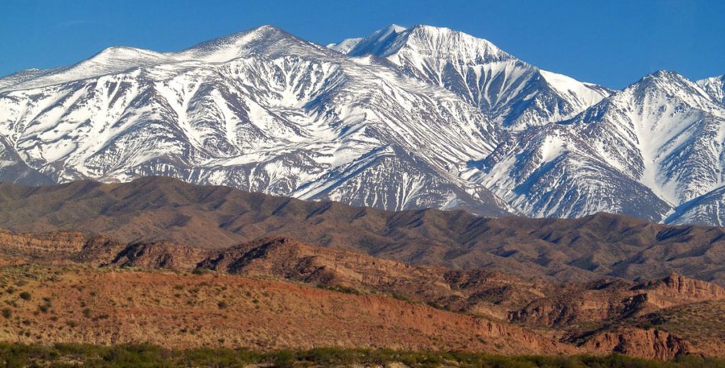
The Cordillera de la Costa runs parallel to the Caribbean along the northern coast of the country. Its two best-known sections are El Ávila, above Caracas, and the Henri Pittier National Park, above Maracay; the German settlement of Colonia Tovar sits in the same central section, at 1,800 metres.
- Getting there: from Caracas and the other coastal cities. Most of this range is a day trip.
- Flora and fauna: mountain eagles and sloths, with vegetation running from tropical forest to cloud forest as you climb.
Main summits of the Cordillera de la Costa
- Pico Naiguatá (2,765 m) — La Guaira. The highest point of the range and the high point of Waraira Repano, visible from Caracas.
- Pico Oriental (2,600 m) — El Ávila National Park (Waraira Repano), near Caracas.
- Pico Turimiquire (2,600 m) — Sucre and Monagas. The high point of the eastern section.
- Pico Occidental (2,480 m) — also in El Ávila National Park.
- Pico La Silla (2,478 m) — the double summit that gives Caracas its outline.
- Pico Codazzi (2,429 m) — Aragua, in the central section near Colonia Tovar.
- Pico Guacamayo (2,215 m) — Aragua, in the central section.
- Cerro Platillón (1,930 m) — Guárico, known for its rock formations and its observatory.
The full guide is in the Cordillera de la Costa.
The Guiana Shield
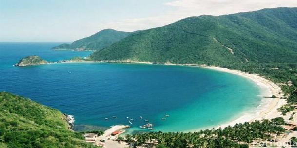
The Guiana Shield covers the south-east of the country. Its interest is its age and its endemism: species evolved in isolation on top of the tepuis and exist nowhere else. It holds Mount Roraima and, on the Auyán-tepui, Angel Falls.
- Getting there: by air and by river, to communities such as Santa Elena de Uairén and Canaima. There is no road to most of it.
- Flora and fauna: the singular vegetation of the tepui summits, with species such as the pebble toad and the giant anteater.
Main summits of the Guiana Shield
- Mount Roraima (2,810 m) — on the border between Venezuela, Brazil and Guyana. The best-known tepui and the standard six-day trek of the region.
- Cerro Marahuaca (2,800 m) — Amazonas. One of the highest tepuis in the country.
- Auyán-tepui (2,450 m) — Bolívar. Angel Falls comes off its wall, with a drop of 979 metres.
- Cerro Sarisariñama (2,350 m) — Bolívar. Known for its sinkholes, huge vertical shafts in the summit plateau.
- Cerro Akopán (2,200 m) — Canaima National Park. Vertical walls and high endemism.
- Cerro Autana (1,300 m) — Amazonas. A tepui sacred to the Piaroa people.
These formations are known less for their height than for what lives on top of them: isolated summit ecosystems, many with plant and animal species found nowhere else. The full guide is in the Guiana Shield.
What there is to do
- Trekking: from half-day walks to multi-day expeditions. Pico Bolívar in the Andes and Roraima in the Guiana Shield are the two classic long routes.
- Climbing: the tepui walls of Canaima are serious technical ground; the coastal range has shorter faces at a range of grades.
- Wildlife watching: Henri Pittier for birds, the Andean páramo for condor and spectacled bear, the tepuis for endemic species.
- Mountain biking: hard climbs and long descents, mainly in the coastal range and around Mérida.
- Paragliding: Mérida and El Ávila have the geography and the operators for it.
- Landscape photography: the light on the páramo at dawn and the tepuis breaking through cloud are the two shots people come for.
- Camping: possible in all three systems, with permits in the national parks. Ask locally before assuming a site is open.
- Local communities: in the Andes and in the Guiana Shield much of the accommodation and guiding is community-run. It is usually the better option, and it keeps the money in the region.
Practical advice and safety
Mountain travel in Venezuela is rewarding and it is not casual. What matters:
- Plan before you go. Check the route, the expected weather and the current condition of the paths. Information online is often years out of date.
- Be fit for what you booked. Altitude and steep ground are hard even on experienced walkers. Be honest about your level.
- Take the right kit. Boots, layers for a 20-degree temperature swing in one day, camping gear if it applies, and a first aid kit.
- Leave your itinerary with someone. Particularly for remote areas, and agree check-in times.
- Take your rubbish out. Respect the wildlife and the rules of the national parks. Several of these ecosystems recover very slowly.
- Use local guides. On Roraima it is compulsory; on Pico Bolívar and Humboldt it is the difference between a trip and an accident.
- Acclimatise. Above 3,000 metres, take the time. Drink water and go at a pace you can hold.
- Carry a map and a compass. A GPS if you have one. Phone coverage disappears quickly.
- Get insurance that covers mountaineering. Standard travel policies usually exclude it. Check the altitude limit in the small print.
- Respect the local culture. In indigenous territory, some places are not open to visitors. Ask.
Conservation
The three systems supply the water for most of the country’s population and hold the bulk of its endemic species, which is why their conservation is a practical question rather than a sentimental one.
The pressures differ by range: urban expansion in the coastal range, the farming frontier and climate change in the Andes, mining in the Guiana Shield. The responses are the same everywhere — protected areas, reforestation, and work with the communities inside them. Sustainable tourism helps when the money stays local; when it does not, it is another extraction.