

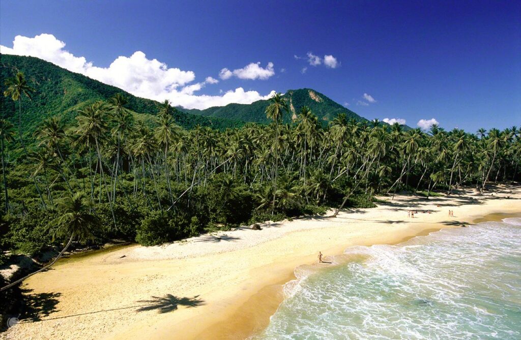
The Cordillera de la Costa is the mountain range that runs along the Caribbean coast of Venezuela, from La Guaira in the west to Sucre in the east. It is the range most Venezuelans see every day: it rises straight out of the sea behind Caracas, Maracay and Valencia, and it holds the oldest national park in the country.
It is also the range that decides where the cities are. The mountains form a wall between the coast and the interior valleys, and the passes through that wall have shaped where people settled, where the ports went and where the farmland is. For a traveller it means something practical: the beach and the cloud forest are often forty minutes apart.
Relief and landscape
The range climbs fast. From the shoreline the slopes reach two thousand metres in a few kilometres, which is why the vegetation changes so abruptly — dry scrub near the sea, cloud forest higher up, open páramo-like grassland on the highest ridges. Between the peaks run deep river valleys and waterfalls that supply the drinking water for the towns below.
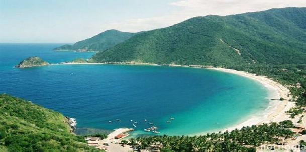
The best-known sections are El Ávila, the mountain that closes Caracas to the north, and the Henri Pittier National Park, the oldest in Venezuela, which drops from the cloud forest of the Portachuelo pass down to the beaches of Choroní and Ocumare.
Climate
Altitude does all the work here. On the coast the climate is tropical, warm and humid all year. Above roughly 1,500 metres it turns cool and wet: on Pico Naiguatá, at 2,765 metres, night temperatures drop close to freezing and the cloud forest sits under mist for much of the day. Pack for both — a beach morning and a cold, wet afternoon on the ridge are the same day out.
The cities of the range
Several of the country’s main cities sit inside this mountain system or immediately below it: Caracas (Capital District), Valencia (Carabobo), Maracay (Aragua), La Guaira (La Guaira), Puerto La Cruz (Anzoátegui) and San Juan de los Morros (Guárico). Between them they hold the political centre of the country, its main industrial belt and its two busiest ports. For the visitor this is the useful part: almost every walk in this range starts within an hour of a city with flights, hotels and car hire.
Biodiversity
The range packs several ecosystems into a short vertical distance, and that is where its biological interest comes from: species that would be hundreds of kilometres apart elsewhere live within one morning’s walk of each other.
Plants and wildlife
The vegetation follows the microclimates. Cloud forest and montane forest hold a wide range of plant species, many of them endemic, among them the araguaney, Venezuela’s national tree, and the orchid, its national flower. Conservation matters here in a literal sense: some of these species exist nowhere else.
The wildlife is as varied. Birds include the oilbird, which nests in the caves of the region, and the range is a well-known corridor for migrating raptors. Mammals include puma and jaguar at the top of the food chain, and there is a large population of insects, reptiles and amphibians that keep the system running. Henri Pittier alone records well over five hundred bird species — one of the reasons it is a fixed stop for birdwatchers.
What there is to do
This is the most accessible mountain country in Venezuela. Nothing here needs an expedition: most of it works as a day out from a city, which is exactly why it gets used so much at weekends.
Hiking and mountain biking
Hiking is the obvious way in. There is a dense network of paths crossing several ecosystems, from paved routes up El Ávila to full-day traverses. For cyclists the range offers hard climbs with long descents — the fire roads above Caracas and around Colonia Tovar are the usual choice.
Paragliding
Paragliding works well in this range, especially around El Ávila, where the flights look down over Caracas on one side and the Caribbean on the other. Thermals build through the morning; most local operators fly early.
Climbing and hillwalking
There are rock faces and peaks at several grades, and enough remote terrain that multi-day walks into hidden waterfalls and valleys are a real option. Go with someone who knows the ground: the paths are not always marked and the cloud comes in fast.
The main summits
El Ávila National Park
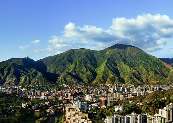
El Ávila — officially Waraira Repano — is more than a mountain: it is the green wall that separates Caracas from the sea and the reference point everyone in the city uses to orient themselves.
- Getting there: the cable car from Caracas, or any of the marked paths that start on the northern edge of the city.
- Flora and fauna: cloud forest, dry forest and open ridge grassland within a single climb, with the bird life that goes with each.
Henri Pittier National Park
The Henri Pittier National Park, the oldest in Venezuela, was declared in 1937. It runs from the Caribbean up into cloud forest and back down to the coast, which is what gives it its unusual species count.
- Getting there: from Maracay via Las Delicias, then on towards Choroní, where one of the park entrances is.
- Flora and fauna: the standard reference for birdwatching in the country, with the Portachuelo pass as the point where the migrations funnel through.
Other peaks worth knowing
Beyond the two parks there is a series of summits that make up the skyline seen from the capital and from the coast. Each is a different level of effort:
- Pico Naiguatá (2,765 m): the highest point of the whole range, between Miranda and La Guaira. A long day or an overnight, not a stroll.
- Pico Oriental (2,600 m): close to Caracas, with well-used paths and views over the city and the Caribbean.
- Pico Occidental (2,480 m): also inside El Ávila National Park, with routes at several grades.
- Pico La Silla (2,478 m): the double summit that gives Caracas its most recognisable outline. Good for birdwatching and landscape photography.
- Pico Codazzi (2,429 m): in Aragua, in the central section of the range near Colonia Tovar.
- Pico Turimiquire (2,600 m): the high point of the eastern section, almost permanently in mist.
- Cerro Platillón (1,930 m): in Guárico, known for its rock formations and its astronomical observatory.
- Cerro Tristeza: in Anzoátegui, a quiet option for wildlife watching.
- Cerro El Copey (930 m): on Margarita island, the eastern end of the system, with views over the Caribbean.
Conservation
Conserving this range is a permanent argument with the cities pressing against it. The main defence has been protection by decree: Henri Pittier in 1937, El Ávila in 1958, and a series of smaller protected areas since. Reforestation and environmental education campaigns work on the edges, and there is ongoing work with local communities on sustainable tourism and farming that does not push the boundary further up the slope. The pressure is real and it is not resolved.
Where this sits in the country
The Cordillera de la Costa is one of the three mountain systems of Venezuela, along with the Venezuelan Andes and the Guiana Shield. The overview of all three is in mountains of Venezuela.