

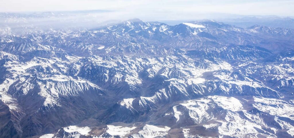
The Venezuelan Andes are the chain that crosses the west of the country, running from the south of Lake Maracaibo down to the Colombian border and drawing the skyline of the Andean states. They are the northern end of the longest mountain system in the world, and they hold everything Venezuela has above four thousand metres.
The high point of the country
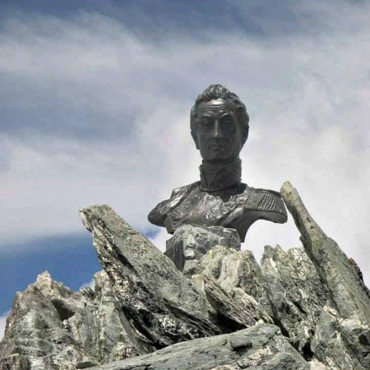
Pico Bolívar, named after Simón Bolívar, is the highest mountain in Venezuela at 4,978 metres. Reaching the summit combines walking, the cable car and technical climbing, and the route shows the whole altitude sequence on the way up — cloud forest, páramo, bare rock. Not far from it, Pico Humboldt stands at 4,940 metres as the second highest summit in the country.
Geography and location
Inside Venezuela the range splits into two main branches: the Sierra de Perijá to the west, on the Colombian border, and the Cordillera de Mérida to the east, which is the one that holds the highest summits in the country. Almost everything a visitor comes for is in the second.
The terrain is high peaks, deep valleys and wide páramo — the treeless high-altitude grassland that starts at around 3,000 metres. Those altitudes also set the local weather: the range blocks and channels the moisture coming off the Maracaibo basin, which is why one side of a ridge can be wet forest and the other dry farmland.
The rivers matter as much as the peaks. Most of the water for the farmland, the towns and the hydroelectric plants of the region starts as rain and mist on these summits. It is one reason conservation here is not an abstract argument.
Climate and ecology
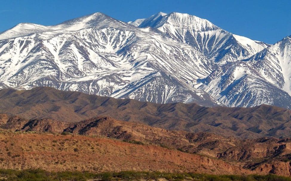
The climate here changes with altitude, not with the calendar. Low down it is warm and humid; as you climb it turns colder and drier, until the páramo, where the temperature drops below zero at night all year round. The valleys and lower slopes stay temperate and green, which is where the coffee and the potato farming are.
That altitude gradient produces the sequence of ecosystems the range is known for: tropical humid forest, cloud forest, páramo and, until very recently, ice. The number of endemic species along that gradient is high, and it is what makes the Cordillera de Mérida ecologically distinct from the rest of the Andes.
Biodiversity
The variety of microclimates and the soil composition support plant and animal life that is diverse and, in a number of cases, found nowhere else.
Endemic plants
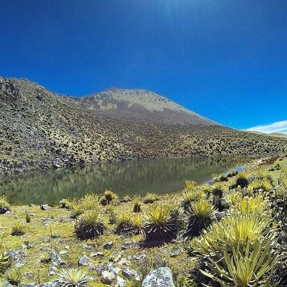
The lower slopes are tropical humid forest, giving way to cloud forest and then to páramo vegetation as the altitude rises. Up there the signature plant is the frailejón, adapted to poor soils and hard frost, and the reason the páramo looks the way it does. There are also orchids and bromeliads, several of them endemic, which hold much of the ecological balance of the region together.
Wildlife
The wildlife is adapted to high-mountain conditions. The emblematic species are the Andean condor and the spectacled bear — the only bear native to South America and the symbol of the Andes. There are also endemic amphibians and reptiles, mammals such as puma and páramo deer, and fish adapted to fast, cold, oxygenated water in the mountain rivers.
What there is to do
The range covers everything from an afternoon walk to a technical multi-day climb. Mérida is the base for almost all of it: it is where the guides, the equipment hire and the transport are.
Hiking and climbing
Hiking is the main reason people come. The paths cross páramo, valleys and rivers, and most of the classic routes can be done without technical gear. Climbing is another matter: the highest summits, Pico Bolívar among them, need equipment, acclimatisation and a guide.
Trekking routes
The best known route goes up towards Pico Bolívar from the Mérida cable car, the highest and longest in the world, which tops out at Pico Espejo, 4,765 metres. It has been out of service for long maintenance periods more than once — confirm it is running before you build a trip around it. The Pico Humboldt trek is the other classic, usually two or three days by way of Laguna Verde.
Adventure sports
Beyond walking, the range is used for paragliding, mountain biking and rafting on the mountain rivers. Mérida has operators for all three. Prices are not fixed and change with the season; ask for what is included before you book.
The three mountains to know
Three places account for most of the trips into these mountains. They are different in difficulty and in what they ask of you.
Pico Bolívar
Pico Bolívar is the highest summit in Venezuela, 4,978 metres above sea level. It carries the name of the Liberator and it is the reference point for the whole range.
- Getting there: mainly via the Mérida cable car, then a trekking and climbing route for experienced mountaineers. It is not a walk-up.
- Flora and fauna: Andean eagles overhead, frailejones and lichen adapted to hard cold on the ground.
Pico Humboldt
Pico Humboldt, the second highest in Venezuela at 4,940 metres, is also one of the most demanding. It is the mountain that carried the last ice in the country: the Humboldt glacier shrank for decades and in 2024 it was reclassified as an ice field — Venezuela became the first Andean country to lose all its glaciers. What is left is a patch of ice, not a glacier, and it is worth knowing that before you go looking for one.
- Getting there: a multi-day trip with specialist guides, starting from the Refugio La Coromoto towards Laguna Verde.
- Flora and fauna: Andean condor and páramo vegetation, both adapted to low temperatures.
Páramo La Culata
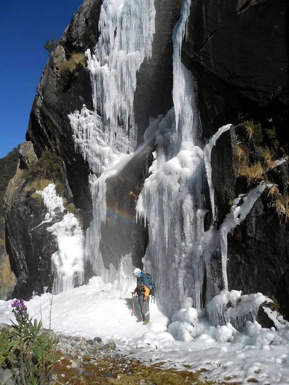
Páramo La Culata is the high, cold, wet moorland north of Mérida — the easiest way to see what páramo actually is without committing to a summit.
- Getting there: from Mérida, along the main road through the town heading towards Mucuchíes.
- Flora and fauna: frailejones and the wildlife that lives with them, above the treeline.
Other notable peaks
The rest of the summits above four thousand metres, all of them in Mérida state and most inside the Sierra Nevada or Sierra de La Culata national parks:
- Pico La Concha (4,922 m): in the Sierra Nevada de Mérida National Park, the third highest in the country.
- Pico Bonpland (4,883 m): in the Sierra Nevada, next to Humboldt, with which it shared the last ice in Venezuela.
- Pico Espejo (4,765 m): the top station of the Mérida cable car, and the only summit at this altitude you can reach without walking.
- Pico Piedras Blancas (4,762 m): also called Misamán, the highest point of the Sierra La Culata.
- Pico El Toro (4,755 m): in the Sierra Nevada National Park.
- Pico El León (4,740 m): between Laguna del Gallo and Laguna de los Anteojos.
- Pico Los Nevados (4,700 m): also called Pico Los Caracoles, in the Mifafí páramo of the Sierra La Culata.
- Pico Pan de Azúcar (4,680 m): in the Sierra La Culata, one of the classic ascents of the range.
- Pico Mucuñuque (4,610 m): also called Pico Santo Domingo, in the Sierra Nevada National Park.
- Pico El Buitre (4,610 m): also called Alto de Micanón, in the Mifafí páramo.
- Pico Mifés (4,580 m): in the Sierra Nevada National Park.
Conservation
The range has real environmental problems and they are not improving on their own. Deforestation from illegal logging and the farming frontier moving uphill; climate change, which has already taken the ice off the summits and is shifting the rainfall patterns the farmland depends on; illegal mining, which contaminates rivers and soil; and poaching, still a pressure on several species.
Against that, the main tools are the protected areas — the Sierra Nevada and Sierra de La Culata national parks, which between them cover the key ecosystems and the endemic species — plus reforestation programmes, work with local communities on sustainable farming, and monitoring of threatened species such as the Andean condor and the spectacled bear. The parks exist on paper and enforcement is uneven; the conservation work that holds is generally the work done with the communities living inside them.
Where this sits in the country
The Venezuelan Andes are one of the three mountain systems of Venezuela, along with the Cordillera de la Costa and the Guiana Shield. The overview of all three is in mountains of Venezuela.